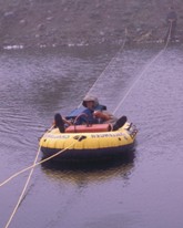
GPR survey conducted in Amchitka Island, Alaska. Survey objective was to map the thickness of drilling mud in several ponds.
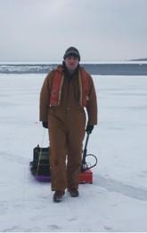
GPR survey conducted in Warren, PA. Survey objectives were to evaluate and map voids beneath the linear of a containment pond.
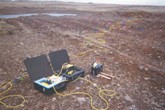
Electrical Resistivity survey conducted at Amchita Island, Alaska. Survey objectives were to estimate the volume of gravel deposits and rippability.
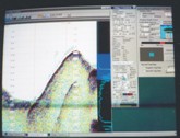
Side scan sonar conducted at Lake Lanier, GA. The survey objectives were to map variations in sediment thickness and depth to bedrock as well as map underwater obstructions that might interfere with planned pipeline contstruction. Side scan sonar profile as it is being collected in the field.

  Geotechnical Services
Geotechnical geophysical services are applicable to many types of investigations. Information obtained through geophysical surveys can prove invaluable to the engineer. Whether it’s planning and design of new construction or remediation systems, geophysical data can be a cost effective tool for many types of projects. Velocity analysis of soils for seismic design and determination of subsurface electrical conductivity are two common applications of geophysics for geotechnical purposes. Evaluations of concrete structures and reinforcement, as well as, detection of voids are applications often applied in an urban environment. Environmental projects often require information regarding bedrock depth and properties including the location of bedrock fracture zones.

Usually it is best to utilize more than one geophysical method. The reason is that one method may not work at a particular site due to soil conditions or other factors. Also, multiple methods will provide confirmation and quality assurance of results. Typical methods used by FPM Geophysical & UXO Services include:

  • Impact Echo
  • Ground-Penetrating Radar (GPR)
  • Seismic Refraction and Reflection
  • Electrical Resistivity and Induced Polarization
  • Borehole methods (crosshole, downhole, and video to name a few)


  • Key Benefits

  • Non-invasive (except for boreholes where needed)
  • Cost effective method to effectively rank and budget structure repairs
  • Very detailed concrete maps of the concrete condition to guide repair
  • Construction safety decisions based on ground truth are always better
  • Can be used to follow-up destructive methods in the most effective manner
  • Minimize and more effectively plan your coring program and other evaluation techniques
  • Accurate location and characterization of hidden anomalies and buried structures


  • Typical Objectives

  • Evaluate foundation materials (soil and rock) and assist engineers to design foundations and structures (borehole velocity surveys, refraction, reflection)
  • Locate and evaluate fault structures and zones near a proposed or existing structure that are potential sources of earthquakes (refraction, reflection)
  • Look for slip zones (like fault offsets) in embankment dams that would indicate earthquake damage or zones of incipient failure
  • Locate cavities or voids in the subsurface as well as under pavement or behind walls (GPR, resistivity)
  • Locate seepage zones (resistivity, TDEM, SP)
  • Evaluate concrete/pavement thickness and rebar rebar position (GPR, impact echo)
  • Determine the thickness and condition of layers in pavements (GPR)
  • Determine depth to bedrock
  • Locate rebar and post-tension cables in concrete
  • Blast / vibration monitoring