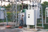
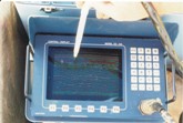
EM utility locating survey conducted in Jackson, TN. Survey objective was to locate and map all utilities.
GPR survey at Agana Power Plant, Guam. Survey objective was to map and locate all utilities.
GPR survey conducted at Redstone Arsenal, Huntsville, AL. Survey objective was to map landfill pits and trenches.
EM-61 and magnetic vertical gradient surveys conducted at Wake Island, U.S. Military Installation. Survey objectives were to locate over 60 underground storage tanks and map approximately 35,000 linear feet of abandoned pipeline.

  Environmental Services
Environmental geophysical services can be an indispensable component to many types of environmental investigations. The non-invasive nature of environmental geophysical methodology is an important consideration when evaluating the financial cost to a project and physical risk to site personnel. Some typical reasons for considering a geophysical survey include:

  • The need for utility clearance/location of buried pipes, electrical or telephone lines to avoid damage during construction.
  • Suspicion of potential buried waste, but limited budget and concern about invasive methods (drilling, excavating). Most geophysical methods utilize non-invasive sensing tools at the surface. The depth of penetration varies depending on soil, but can be as much as 50 feet. The cost for a competent survey is very reasonable.
  • Need for a quick, unambiguous geophysical survey to eliminate the possibility of buried drums or tanks. Sometimes there is not enough time to wait for Phase I and Phase 2 Site Assessments. Geophysical surveys can be done in less than 1 week.
  • Need for better understanding of tank or abandoned well location, or extent of buried structures or voids, and site stratigraphy, such as buried channels, in order to direct drilling and excavating. Geophysics can locate buried objects often to less than one meter.


  • FPM Geophysical & UXO Services typically uses at least two of the following methods:

  • Electromagnetic
  • Electrical resistivity
  • Borehole geophysical logging
  • Seismic refraction & reflection
  • Ground-penetrating radar (GPR)
  • Potential field (e.g., magnetics or gravity)


  • Key Benefits

  • Low cost
  • Non-invasive
  • Identification of subsurface hazards
  • Accurate surveying and location of buried objects


  • Typical Objectives

  • Locate subsurface utilities
  • Determine depth to bedrock
  • Delineate landfill boundaries
  • Delineate contaminate plumes
  • Identify preferential contaminant pathways
  • Locate underground storage tanks and drums