

| Environmental | |||||
| Engineering | |||||
| Gps |
| All the information you need to get the best car GPS |
| Seismic |
 Home Home |
 Services Services |
 Methods Methods |
 Uxo Uxo |
 Contact Us Contact Us |
 About us About us |
GPS / GIS Methods
|
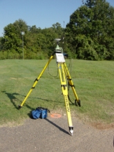
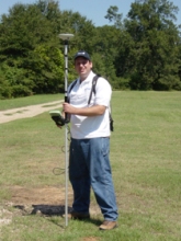
Using land survey techniques such as Global Positioning System (GPS) and total station as the positional control method for some types of geophysical surveys can increase efficiency. Geophysical work which requires high density data, such as EM and Magnetic surveys that are located in rugged terrain or thick brush/vegetation, and work requiring precise measurement of surface elevation, as would be necessary for gravity and seismic surveys, often benefit from use of GPS/total station. Surface positional accuracy can range from centimeter level to over 5 meters, depending on the components used. In areas where GPS won’t function properly due to dense tree canopy or other obstructions, the use of a Robotic Total Station (RTS) may be more suitable for positional survey control. FPM personnel have years of experience and can determine the best positional control option based on the objectives of the project, budget and site conditions.
GPS operation is based on satellite trilateration and ranging, accurate timing, satellite positioning, and correcting errors. Satellite trilateration is used to determine the location of a point from its distance to three satellites, although in practice, a fourth satellite is used to solve for X,Y,Z, and time. Satellite ranging is established by measuring the travel time of radio signals from the satellite to a GPS receiver. By multiplying the signal travel time by the speed of light, the distance to that satellite can be calculated. Most GPS systems rely on highly accurate clocks. However, since ground receiver clocks are not as accurate as atomic satellite clocks, a fourth satellite is used to remove clock errors. Satellite positioning for the 24 NAVSTAR (NAVigation Satellite Timing And Ranging) satellites is monitored and maintained by the U.S. Department of Defense. Clock and directional corrections are transmitted to satellites at least once per day. The use of GIS for geophysical applications allows the seamless integration of geophysical data and land survey data with existing and future databases. We are capable of providing many types of geophysical data in a form that is readily accessible to the GIS user. Many federal and municipal entities have adopted and rigidly adhere to the Spatial Database Standards for Facility, Infrastructure and Environment (SDSFIE). The SDSFIE standard enables a high level of communication and interoperability of GIS/CADD data between organizations and institutions. FPM is experienced with implementing the standards and promotes their use whenever appropriate. To learn more about SDSFIE follow the link to the CADD/GIS Technology Center for Facilities, Infrastructure and Environment
|


