

| Environmental | |||||
| Engineering |
| Gps |
| All the information you need to get the best car GPS |
| Seismic |
 Home Home |
 Services Services |
 Methods Methods |
 Uxo Uxo |
 Contact Us Contact Us |
 About us About us |
UXO Services
|
The principal objective of unexploded ordnance (UXO) geophysical surveys is to detect the presence of UXO and/or safety remediate UXO contaminated areas. Accuracy is critical; We achieve accuracy by adhering to stringent Standard Operating Procedures (SOP’s), selecting the most appropriate geophysical instrumentation to detect UXO items for a specific site, and using the highest resolution land survey systems available [e.g., survey-grade RTK Global Positioning Systems (GPS), robotic total station (RTS) systems, and psuedo-satellite systems (PSS) or “psuedolitesâ€]. We often integrate the geophysical and land survey data into a Geographic Information System (GIS) to capture all the attributes (e.g., aerial photos, utility plans, and cultural resource information) and provide a “one-stop†data management tool used by our customers.
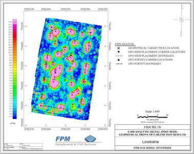
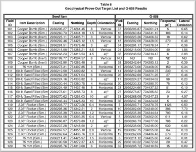
Prior to performing a UXO survey, we usually conduct a geophysical prove-out (GPO) employing multiple geophysical systems to determine which system is best suited for site specific objectives, soil conditions and other factors. The GPO also provides several unique data sets that aid with UXO discrimination, confirmation and quality assurance of production survey results. Typical methods used by FPM Geophysical and UXO Services to conduct UXO investigations include:
Key Benefits Typical Objectives
|


|


